

How Many Seismic Zones Are There in India?
F
Discover verified facts, data, and insights about India’s states, culture, economy, education, and more — all in one place at FactBharat.
Search for a command to run...
Discover verified facts, data, and insights about India’s states, culture, economy, education, and more — all in one place at FactBharat.
No comments yet. Be the first to comment.
Moving to the USA from India is a dream for many. Whether you want to study, work, or live with family, the process can seem complex. But with the right information, you can plan your move confidently. I’ll guide you through the key steps and options...
Opening a college in India is a dream for many educators and entrepreneurs who want to contribute to the country’s education sector. If you are one of those who want to start a college, you need to understand the process clearly. It involves several ...
Opening a hospital in India is a significant and rewarding venture. If you’ve ever wondered how to start one, you’re in the right place. Whether you’re a healthcare professional, entrepreneur, or investor, understanding the process is crucial. You’ll...
Opening a medical store in India can be a rewarding business opportunity. You get to serve your community by providing essential medicines and healthcare products. If you are thinking about starting a medical store, you might wonder where to begin an...
Opening a restaurant in India can be an exciting and rewarding venture. Whether you dream of serving traditional Indian dishes or international cuisine, the process involves careful planning and understanding of local regulations. If you’re ready to ...
FactBharat | Insights About India
2558 posts
Discover verified facts, data, and insights about India’s states, culture, economy, education, and more — all in one place at FactBharat.
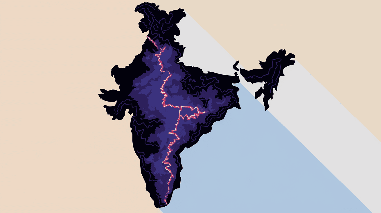
India is a vast country with diverse geography, and understanding its seismic zones is crucial for safety and planning. If you live in or are visiting India, knowing how many seismic zones the country has can help you appreciate the risks of earthquakes in different regions. It also guides builders and policymakers in making safer choices.
In this article, I will explain how many seismic zones India has, what each zone means, and why this classification matters. You’ll learn about the areas prone to earthquakes and how this knowledge helps protect lives and property.
Seismic zones are regions classified based on the likelihood and intensity of earthquakes. These zones help predict where earthquakes might occur and how strong they could be. In India, seismic zones are defined by the Bureau of Indian Standards (BIS) to guide construction and disaster management.
The zones are determined by studying historical earthquake data, geological features, and tectonic plate movements. This classification helps engineers design buildings that can withstand earthquakes appropriate to their location’s risk level.
India is divided into four seismic zones, labeled Zone II, Zone III, Zone IV, and Zone V. Each zone represents a different level of earthquake risk:
This zoning system replaces the earlier five-zone system, simplifying the classification while maintaining safety standards. The zones cover different parts of the country based on their seismic activity.
Understanding the characteristics of each seismic zone helps you grasp the earthquake risk in various parts of India.
Zone II covers areas with the least chance of earthquakes. These regions experience very mild tremors, if any.
Zone III includes areas with moderate earthquake activity.
Zone IV is for regions with a high chance of strong earthquakes.
Zone V is the most dangerous seismic zone in India.
India’s seismic zones are shaped by its unique geology and tectonic setting. The country lies on the Indian tectonic plate, which is moving northward and colliding with the Eurasian plate. This collision causes intense geological activity, especially in the Himalayan region.
This natural setup explains why some parts of India face frequent earthquakes while others remain calm.
Knowing the seismic zone of an area is vital for building safe structures. The Bureau of Indian Standards has developed the IS 1893 code, which specifies earthquake-resistant design requirements based on seismic zones.
Builders, architects, and engineers use these guidelines to design buildings that can survive earthquakes, reducing casualties and economic loss.
Seismic zoning also guides disaster management plans and urban development.
India has experienced earthquakes of varying intensity across its seismic zones.
These examples highlight why seismic zoning is essential for safety.
If you want to know the seismic zone of your area, you can:
Knowing your zone helps you understand the earthquake risk and take necessary precautions.
India continues to improve its seismic zoning and earthquake preparedness.
These efforts aim to make India safer despite its seismic challenges.
India has four main seismic zones, ranging from low to very high earthquake risk. These zones help guide construction, urban planning, and disaster management to protect people and property. Understanding your seismic zone is important whether you live in a calm area or a high-risk region.
By following building codes and safety measures based on seismic zones, India is working towards reducing the damage caused by earthquakes. Staying informed and prepared can make a big difference in how we face natural disasters.
India has four seismic zones: Zone II (low risk), Zone III (moderate risk), Zone IV (high risk), and Zone V (very high risk).
The highest risk Zone V includes parts of Kashmir, Himachal Pradesh, Uttarakhand, and northeastern states like Assam and Nagaland.
Seismic zoning helps identify earthquake risk areas to guide safe construction, urban planning, and disaster preparedness.
Buildings in higher seismic zones must follow stricter earthquake-resistant design codes to minimize damage during earthquakes.
You can find seismic zone maps on the Bureau of Indian Standards website or through government disaster management portals.